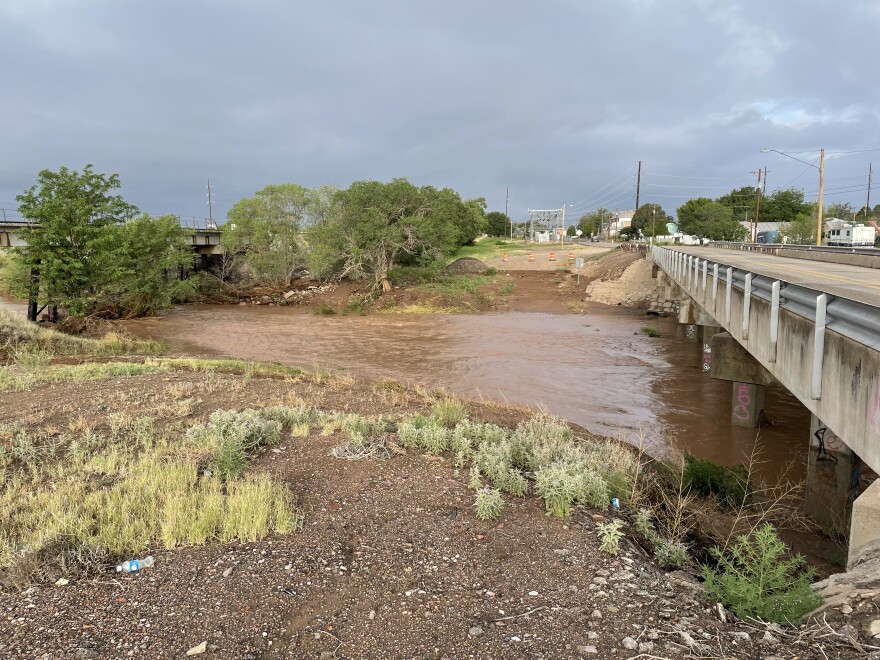
Parts of West Texas have seen over a half-foot of rainfall in the last few days, which has led to flooded neighborhoods, vehicle rescues and at least one death so far.
By Public Radio Staff
Wednesday, 7:10 a.m. update — Threat of flash flooding continues today
According to the National Weather Service, flash flooding is a possibility on Wednesday primarily in Culberson County. There is a likely chance for some rainstorms Wednesday with "locally heavy rain" possible, according to the NWS.
The best chance of thunderstorms producing heavy rainfall will reside over Eddy and Culberson Counties where a Flash Flood Watch is in effect. Widely scattered thunderstorms are possible elsewhere today and early tonight. #txwx #nmwx pic.twitter.com/aNqHKZ5d8U
— NWS Midland (@NWSMidland) June 30, 2021
2:30 p.m. update — Presidio County officials recover second vehicle in flooded creek.
1:42 p.m. update — National Weather Service extends Flash Flood Watch until Wednesday morning.
The flash flood watch issued is now in effect through Wednesday morning at 7. The notice covers all of Culberson, Ector, Jeff Davis, Midland, Presidio and Reeves counties, as well as northern Brewster County.
1:30 p.m. update — Resources for West Texans whose homes have flooded.
While the Permian Basin Red Cross office hasn’t set up shelters for residents whose homes have flooded, they are providing aid to anyone in the Midland-Odessa area, the Big Bend region and beyond.
If your home begins to flood or already has, call 1-800-733-2767 to contact the Red Cross for help.
10:30 a.m. update — A 55-year-old man was killed in a flash flood in Marfa Monday night.
Marfa Police Chief Estevan Marquez says Marfa resident David William Tompkins was killed when his vehicle washed away at a creek crossing south of the town’s Dollar General store around 10 p.m. Monday.
The sheriff’s office says it’s also still investigating reports of a second vehicle that washed away in the same area.
9:30 a.m. update — Region sets records for daily rainfall.
Rick Hluchan, a meteorologist with the National Weather Service in Midland, says the rain that's been falling in the Midland-Odessa area is some of the most the region's received in the last 90 years, breaking multiple single - day records over the last four days.
What an incredible stretch of wet weather we have endured over the last few days! Another daily record rainfall total of 1.29" was set yesterday along with a record minimum high temperature of 79°F! #txwx pic.twitter.com/xg1ufzP8OG
— NWS Midland (@NWSMidland) June 29, 2021
Hluchan also says over the next few days, high terrain areas are also expected to receive heavy rainfall and are at risk for flash floods. The Big Bend region up to the Guadalupe Mountains could see 2 to 4 inches of rain in the next few days.
7:09 a.m. update — The National Weather Service says a Flash Flood Watch continues Tuesday for much of the region.
A flash flood watch means flooding is possible near or downstream of any storm. The National Weather Service is forecasting heavy rain this afternoon and tonight, from the Permian Basin down to Marfa and wider stretches of the Trans-Pecos. The heaviest rainfall is expected in Southeast New Mexico and the Permian Basin.

